TouchScreenTravels logo

TouchScreenTravels

Our Touch, your Travels…

This is a preview of the full content of our Devon & Cornwall’s Best app.

Please consider downloading this app to support small independent publishing and because:

  • All content is designed for mobile devices and works best there.
  • Detailed in-app maps will help you find sites using your device’s GPS.
  • The app works offline (one time upgrade required on Android versions).
  • All advertising (only present on Android versions) can be removed.

The app will also allow you to:

  • Add custom locations to the app map (your hotel…).
  • Create your own list of favourites as you browse.
  • Search the entire contents using a fast and simple text-search tool.
  • Make one-click phone calls (on phones).
iOS App Store Google Play

Widecombe-Hamel Down Hike

Ridge top walk with dramatic views (8 miles)

Sticks on Hamel Down - Hay Tor in the distance

The Hamel Down Ridge sweeps north just west of the pretty village of Widecombe-in-the-Moor. From the village make for the Two Moors Way – pick up Ordnance Survey map OL 28; Dartmoor in local shops and check the way.

Once up on the ride you simply walk north amid broad views. You’ll also pass four separate prehistoric burial mounds, the 1854 Hamel Down Cross and WWII anti-glider poles.
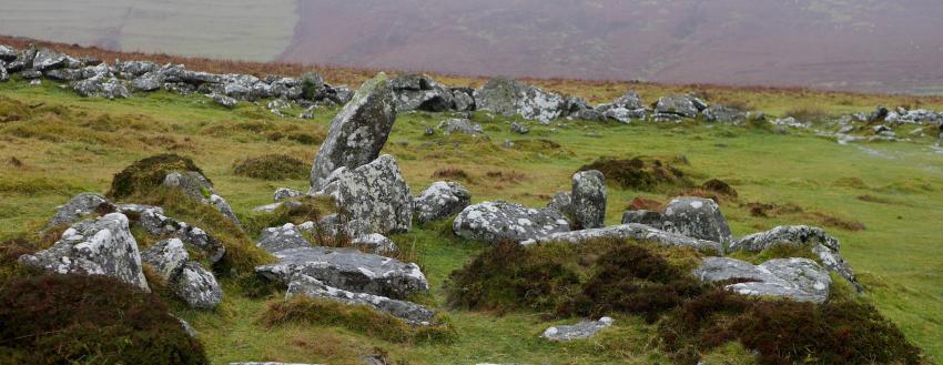
Stone Hut at Grimspound

After 3 miles the ridge ends with views down onto Grimspound. This massive Bronze Age enclosure contains the remains of more than a dozen prehistoric homes.

After descending to explore it, you just turn around and retrace your steps south. Back in Widecombe, the Rugglestone Inn is the place to refuel.

Practical Info Practical Info icon

Trail head Village green, Widecombe-in-the-Moor. TQ13 7TA (this entry’s map location)

Route Info twoblondeswalking.com

Dartmoor Walks

Text © Belinda Dixon

Images by Arwen_7, Tony Hirtenstein